

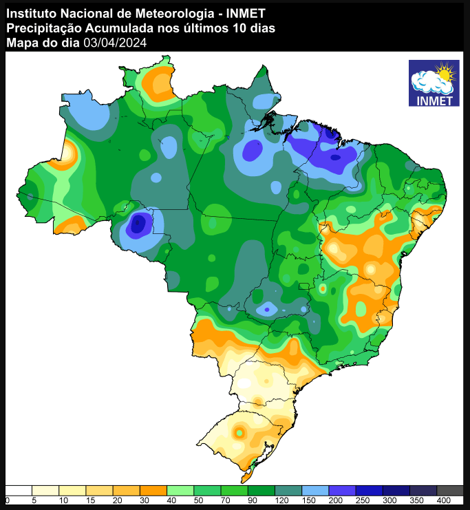
After a few days without recording significant precipitation, the south of Brazil is once again on alert for intense rain in the coming hours. According to official data from the National Institute of Meteorology (Inmet), in the last ten days significant volumes were recorded in the Center-North of Brazil, confirming previous forecasts.
See the map of precipitation recorded in recent days across Brazil:
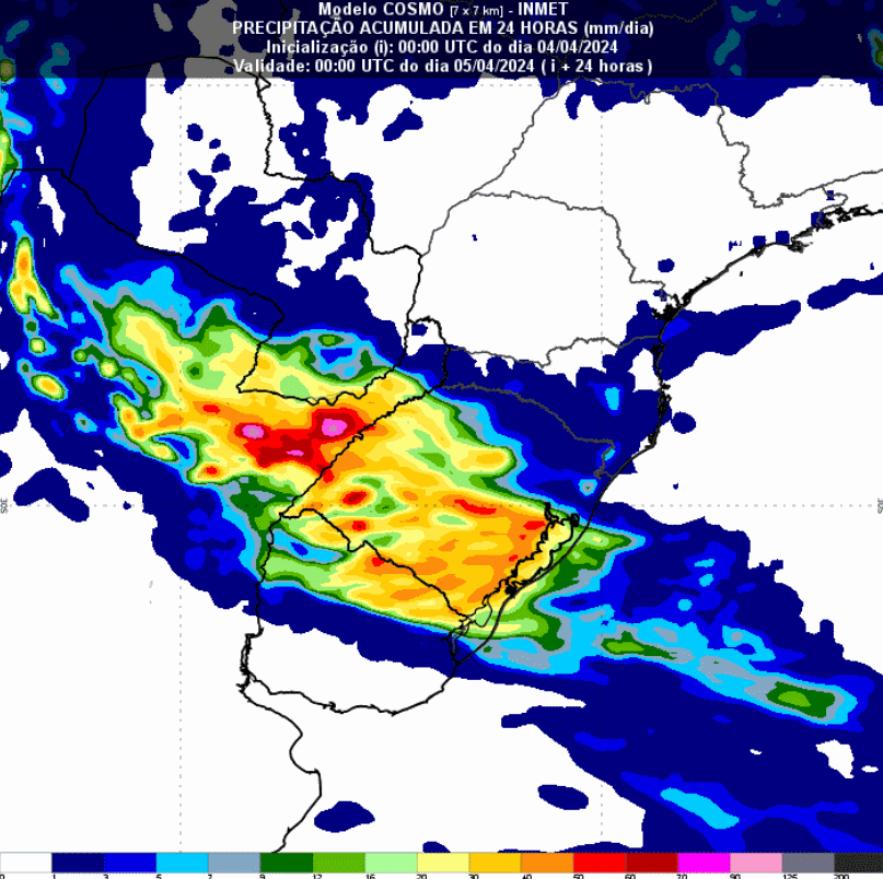
Starting this Thursday (4), the advance of a new cold front should change weather conditions in the region. Meteorological models show that several fronts are expected to act in Rio Grande do Sul and also advance to the other states in the region. For the next 24 hours, Inmet has issued yellow and orange alerts for intense rain valid in the southern state of Rio Grande do Sul.
“Rain between 30 and 60 mm/h or 50 and 100 mm/day, intense winds (60-100 km/h), and hail. Risk of electricity cuts, damage to crops, falling trees and flooding”, states the official publication.
Climatempo adds that the concern in the south of Rio Grande do Sul is even more intense due to the exceptionally high rainfall levels recorded in March, mainly in the west, campaign and south areas of the state.
The Cosmo model predicts, however, rain conditions in other areas of the state with accumulations of between 20mm and 40mm between this Thursday and Friday (5). For Santa Catarina and Paraná, the forecast is for areas of instability to advance, but with lower volumes.
See the rainfall forecast for the next few hours in southern Brazil:
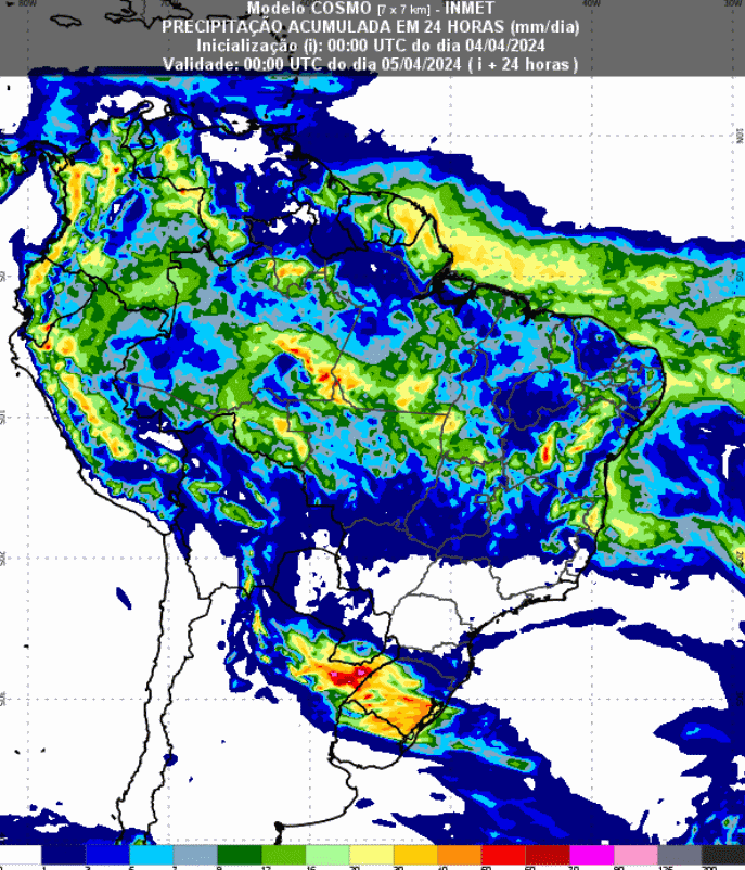
As for the other regions of Brazil, the models indicate that areas of instability will remain in the Center-North of the country. However, the Matopiba areas stand out, which should receive the most significant volumes. This scenario emphasizes the importance of continuous monitoring for the region.
In the coming days, Tocantins and western Bahia may record accumulations of between 20mm and 50mm. It also rains in areas of the Central-West and Southeast, but with lower volumes.
See the precipitation forecast map for the next 93 hours across Brazil:
Source: Virgínia Alves | Notícias Agrícolas

")
")